
Transportation is changing at a meteoric pace. Change that used to happen in three years now happens in three months. With so many privately operated, publicly accessible modes coming to streets near you (and soon AVs), it’s a critical time to ensure the community’s values are reflected in cities’ policies. As we wrote last week — in the era of new mobility, the streets of the future must change.
Today, Remix is launching the first platform that brings together the entire transportation picture: public transit, the abundance of new mobility options (like scooters and bikes), and streets that support it all.

With Remix, cities can take a proactive role in managing both public and private transportation, ensuring equitable, safe, and accessible outcomes. To help cities achieve these goals, we’re launching two new offerings:
We recently surveyed 50+ municipalities with populations ranging from 20,000 to 1.5 million across North America and Europe. Some key findings:
Clearly, cities all over are experiencing rapid changes in mobility and eager to guide the change through policy and infrastructure investments. Based on recent history, cities also need to be prepared with better tools and data to do it right — to dictate local transportation outcomes.
Here are three ways that the new platform helps cities plan their transportation future:
We help cities visualize all the data from multiple providers in the same platform to understand the full picture (instead of one at a time). By seeing usage, placement, historical, and real-time data, cities can answer questions from the public and elected officials such as: what corridors are most popular throughout the day? Is it so popular that there’s a need for additional infrastructure investment, or stronger enforcement around parking?

Understanding how new services are being used in different neighborhoods — especially those that may have traditionally lacked reliable transportation options — can help inform new policy decisions.
For example, several cities have enacted policies suggesting X percentage of scooters in specific zones each morning. For those cities, it’s important to 1) regularly validate if those requirements are being met, and 2) use the data to determine if the desired outcome is being achieved. These outputs can then be used to refine policies over time.

If we understand how new mobility and transit interact, we can start to prioritize infrastructure investments to support people using all modes. For instance, an overcapacity corridor could become a complete street with bus rapid transit, pedestrian bulb-outs, and a complementary bike network.

With Remix, you can see the impact of new mobility on the transportation system and dynamically evaluate proposals needed to better achieve community goals.
We champion open data formats at Remix, to ensure that both city and provider data are always accessible and interoperable. Our first product was built on the General Transit Feed Specification, so we understand the power of open data standards to transform an industry. There are two new open data efforts that are making this specific work possible for the first time:
The Remix Policy team is actively researching these standards and policies, and we’ll be sharing more learnings in the coming weeks. Stay tuned.
Obviously, new technology is meaningless without impact. We’ve already been working with 6 early customer cities on street design, and here’s how Remix has influenced streets in those communities to date:
There’s a rare convergence of four things happening right now that cities cannot ignore:
Altogether — it’s a once-in-a-lifetime opportunity to rethink transportation. Will cities choose to watch from the sidelines, or play a central role in shaping their future?

Introducing On-demand Planning: The first planning product for on-demand and flexible fleets that is data-driven, integrated with the fixed-route network, and collaborative.

Meet New Remix, designed to be more intuitive, flexible, and more powerfully multimodal.
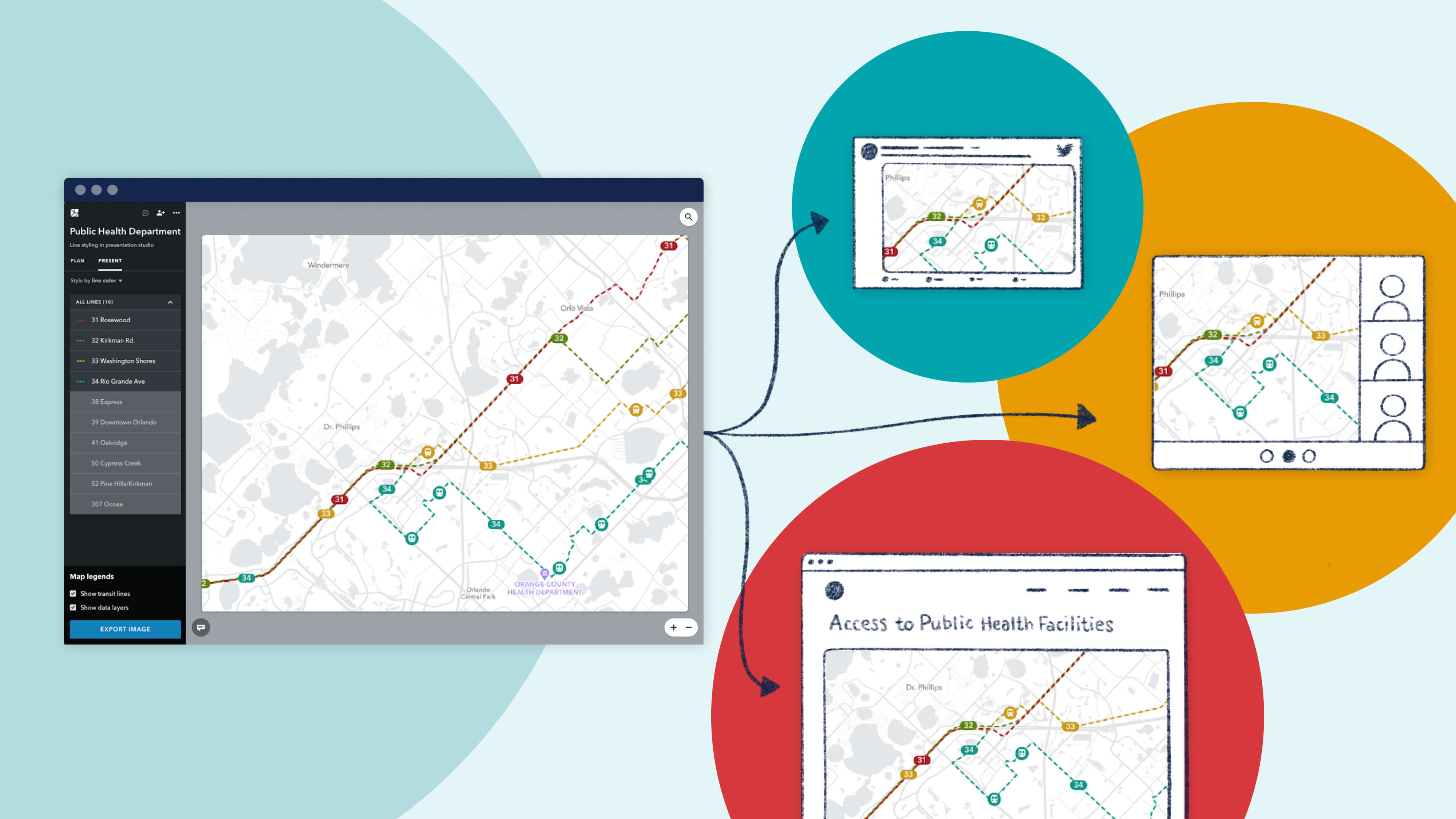
Since launching Presentation Studio, we’ve been delighted to see the creative ways in which our partner agencies are using the feature. We're proud to showcase their work with a "Map Gallery."

